Sand Keeps Moving
No one who lives at the beach is surprised when they hear that some sand has moved. It happens on the beach. Even roads get sand covered here. We plow sand at the beach like folks plow snow up North.
Still the story of the Point at Emerald Isle is an amazing story even to those of us accustomed to sand moving.
In late October, 2007, a little over a year after we moved here to the Southern Outer Banks, I decided that I would get a beach driving permit. It did not take long to get one from the folks in Emerald Isle. Right after we got it, we headed towards the Point. We went down Coast Guard Road and turned right onto Inlet Drive. That takes you to as far west as you can go. Just before the road turns right and heads north a short distance before ending, there is a beach access for vehicles. It is open from September 15 until April 30 except for seven days around Easter.
The day we went there with our new permit, we were surprised with what we saw, but first I will give you some background information on the Point.
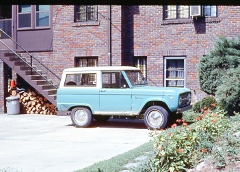
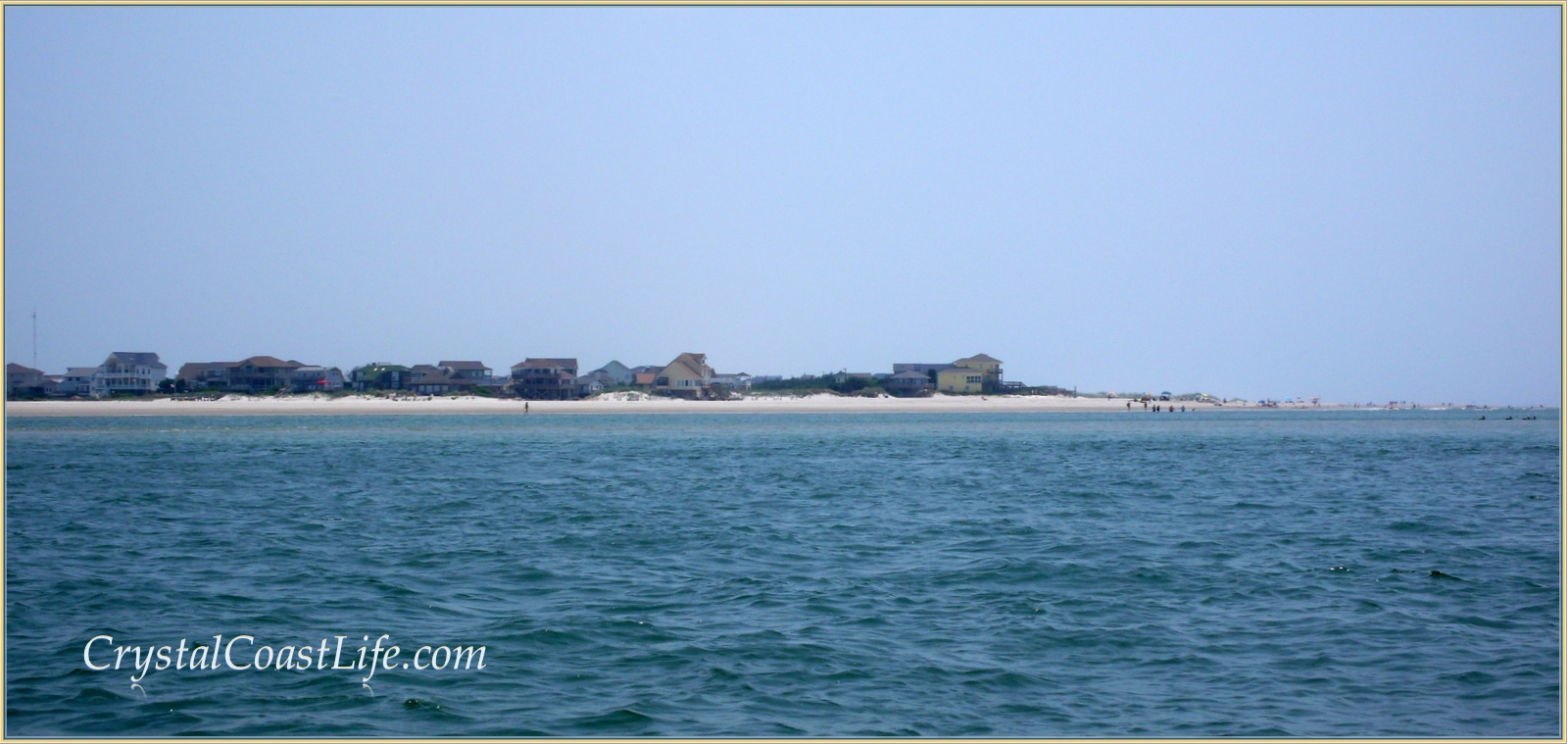
I have a little personal history with the Point. I first visited it in the summer of 1969 as a college student. My Uncle Austin and I drove down Bogue Banks in my lime green Ford Bronco from Morehead City. Most of our drive was along the beaches since there were no roads on the western end of the Point.
We had a great day fishing there and it is one of the memories that I cherish. I can still remember seeing Bear Island in the distance. Some place in my photo collection there is a picture of me standing on the beach that day.
Around thirty-eight years later during our first year as area residents, we watched as the Point steadily got smaller. More and more of the sand was being taken over by water. Still that first drive down to the Point vehicle access with our permit gave us a shock. The sand area was dramatically smaller than we remembered from a visit just a few weeks earlier. There were about a dozen trucks on the Point that visit and it looked too crowded for any fun so we decided to delay our first beach driving experience.
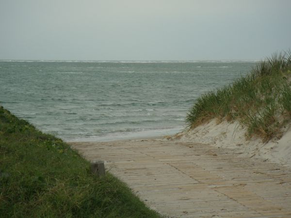
The bigger surprise was to come a couple of weeks later. When we stopped at the ramp for a second try on beach driving, we found the ramp closed and all of what we remembered as the Point was underwater as you can see from this November 4, 2007 photo. It was December 2008 before the access to the Point was repaired. There are more pictures and information about the time just before the Point disappeared and when the ramp was repaired at this December 2008 post, The Changing Coast Line.
Even in August of 2009, as you can tell from these photos things had gone backwards again and the ramp to the Point was useless. In spite of that the set back, things were really beginning to change. You can see from this picture taken on June 24, 2010 that a new and bigger Point was emerging from the waters.
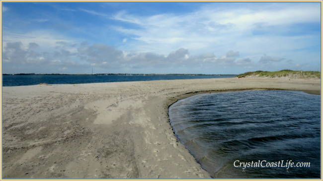
The sand at the Point has continued to accumulate. Even after Hurricane Sandy the Point added more sand.
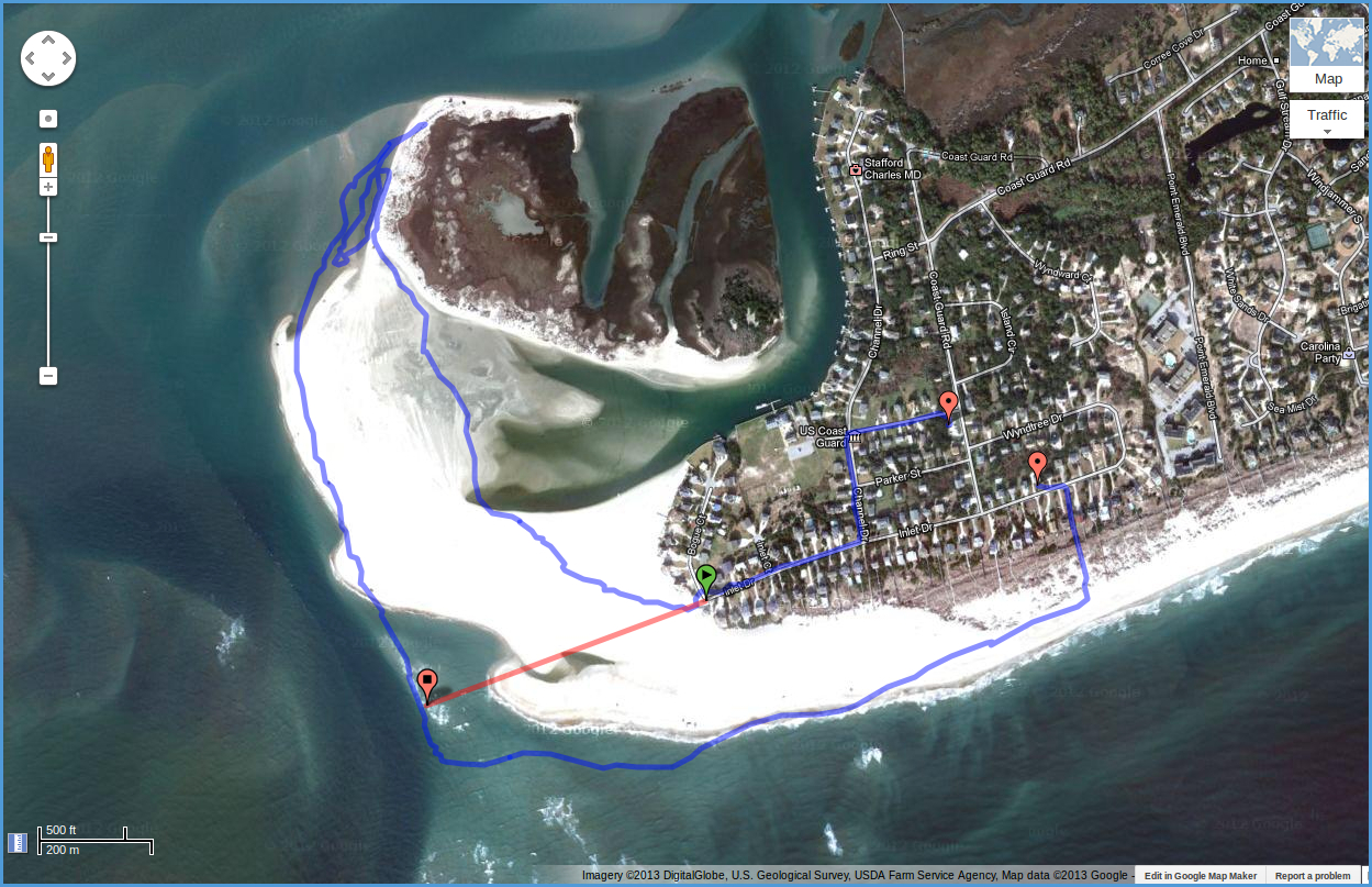
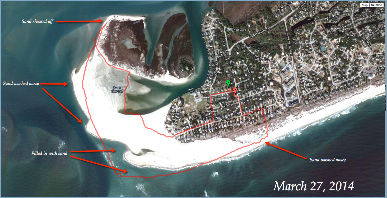
Even in the two years since March 2012 when I created this flash based map with pictures the changes have been dramatic. If you compare that August 2011 map with this one which I created on May 21, 2013, you will find that the land bridge which I have used as the photo for this post did not even exist 21 months ago in March 2012. The changes have not stopped. This map based on my March 27, 2014 walk shows even more changes and last year’s land bridge has disappeared as you can see in this March 2014 picture.
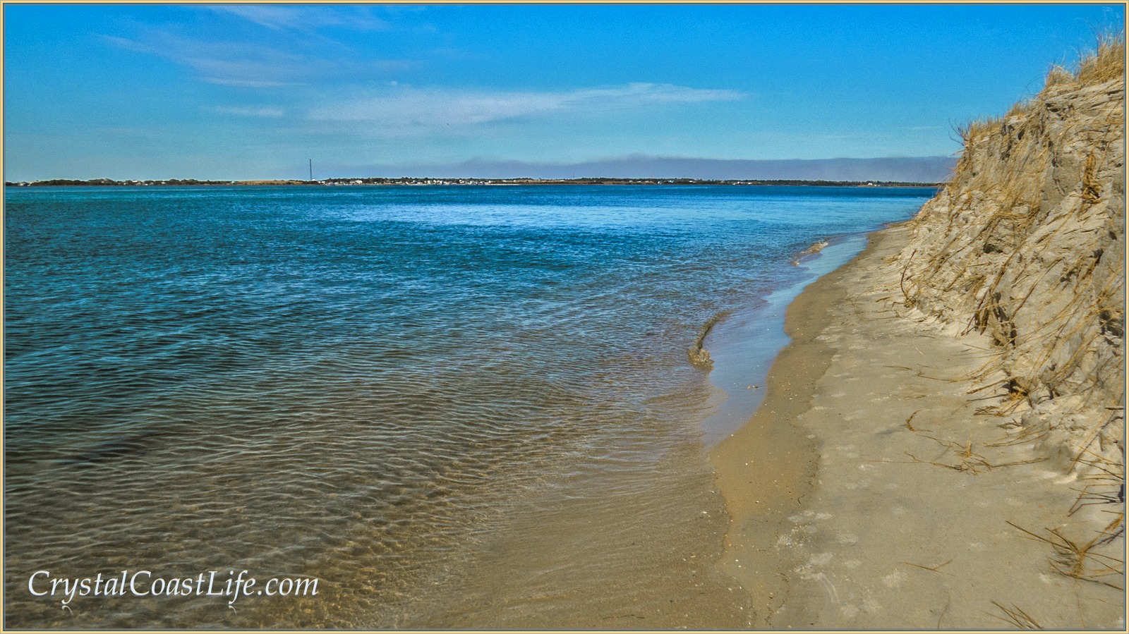
The red line in the March 27 map is the track of my beach hike. Google’s map shows me walking on water, but that is not the case. This particular hike started at around mid-tide and finished a couple of hours before high tide. There was plenty of sand and there would have been acres more at low tide. Of special note is this picture of where I turned back at the new cliffs where the tides have sheared off the sand at the backside of what used be a nice beach leading to an area that was popular with locals.
If you go back and look at the May 2013 map, the red line on the map runs from the farthest western spot along the surf on the Point to the vehicle ramp which looked out over nothing but water in November of 2007.
The red line was 1748 feet long in May 2013 The ocean has added that much sand in less than six years. Unfortunately Google has turned off their distance measurement tool so I cannot tell you exactly how far it is to the water in March 2014 but I will figure it out eventually.
That beach which used to run along the north side of Bird/Coast Guard Island toward the bottle trees is now gone along with the bottle trees but there is plenty of sand in other places. You can find all the solitude you need on the northern end of the Point.
There are more details on the Point and links to lots of pictures at this post, Back to the Point and this even more recent one, An Irresistible Beach. I love beaches, especially the one at the Point, so I am happy to follow the adventures of the changing sands there.
There are lots of pictures of the Point and the Emerald Isle area in my new Kindle Book, 100 Pictures, 1000 Words, A Crystal Coast Year, and you will find complete beach information in our recent 2013 Emerald Isle Travel Guide.
If you would like to read more about the Crystal Coast and why we are living here, you will find some helpful posts at this link. More information about life here can be found at my Crystal Coast Life blog. This is the signup link for our monthly newsletter about the Crystal Coast.